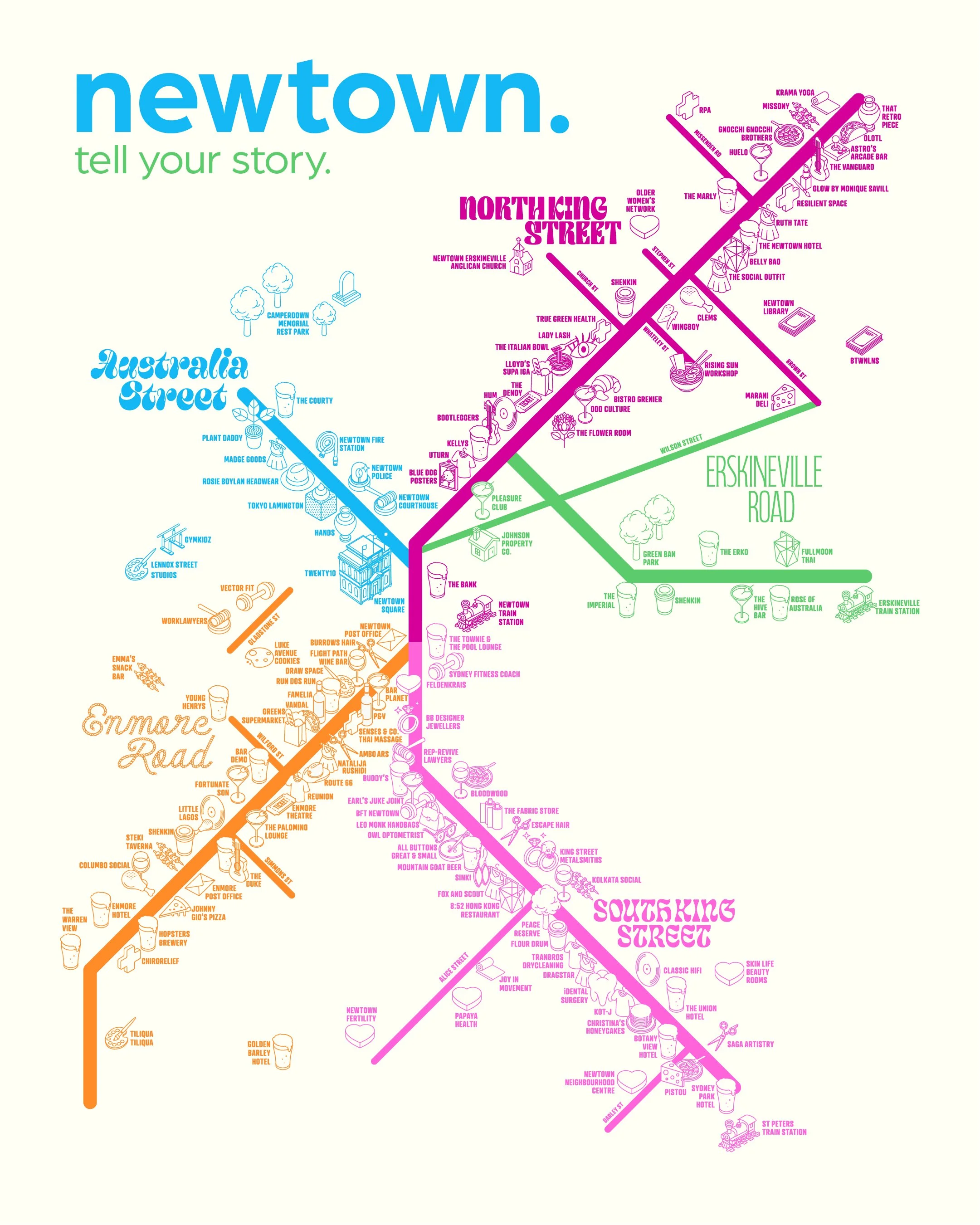
DOWNLOAD MAP

MAPPING OUR DISTRICT
If you’ve ever wandered past Newtown Station and caught a glimpse of the old precinct map - sun-faded and barely clinging on - you’ll know why we needed to do something. That map, first installed by the former Chamber of Commerce, had not been replaced since 2018 (we think). So we set out to update it. But what began as a simple replacement became something much bigger… as per everything we do.
Thanks to funding from the City of Sydney through the Business Sector Support Grant, with additional support from Inner West Council and the NSW Government, we’ve created something that does more than just show you where the shops are. This new map helps tell the story of who we are.
Working with Good Decisions, we ran collaborative consultations with our precinct committee and a dedicated subcommittee, each representing their patch within what we’ve come to call our “burrows”: King Street South, King Street North, Enmore Road, Australia Street and Erskineville Road. We didn’t forget the hidden gems down the laneways either.
These sessions were open, reflective and packed with insight. Members weighed in on everything, from the layout of the streets to the colour palette and the names themselves. Lachlan from Good Decisions brought it all together, leading the way with care, clarity and a solid sense of what matters to our community.
The final design now lives in display cases, on digital screens, printed postcards and billboards at the gateways to our precinct. It’s a vibrant snapshot of where we are right now.
This map is just the beginning. We’ll be updating it twice a year (pending further funding and ad sales!) growing the story as new member businesses join and feedback continues to shape its future. It’s a map that moves with us.


